This level hike in Howell Township loops around the Manasquan Reservoir, built in the 1980s by damming the Manasquan River to provide a supply of water for adjacent municipalities. For most of the way, the hike follows the wide, multi-use Perimeter Trail, surfaced with fine gravel or dirt and used by walkers, joggers and bicyclists, but it detours onto the pedestrian-only Cove Trail for about...
Hike Description:
This level hike in Howell Township loops around the Manasquan Reservoir, built in the 1980s by damming the Manasquan River to provide a supply of water for adjacent municipalities. For most of the way, the hike follows the wide, multi-use Perimeter Trail, surfaced with fine gravel or dirt and used by walkers, joggers and bicyclists, but it detours onto the pedestrian-only Cove Trail for about a mile. The Perimeter Trail often parallels roads that run close to park’s boundary, but for the most part, vegetation shields the roads from view, especially when the trees are covered with leaves. The hike is described in the counter-clockwise direction, starting from the Environmental Center on Georgia Tavern Road.
From the crosswalk at the entrance to the parking lot at the Environmental Center, head south on the wide Perimeter Trail, marked by a signpost. In 500 feet, you’ll reach a junction with the Cove Trail, which begins on the right. Turn right onto the Cove Trail, a pedestrian-only trail that follows a narrow footpath, looping around the southwestern corner of the reservoir. Along the way, you’ll cross several bridges over streams and wet areas.
In about a mile, after passing through dense barberry thickets, the Cove Trail ends at a dirt road that leads to the reservoir from the nearby Windeler Road. Turn left and follow this dirt road a short distance to the Perimeter Trail, then turn right onto the Perimeter Trail, which will be your route for the remainder of the hike. The Perimeter Trail crosses two bridges and continues on a very wide road, passing a ranger residence and maintenance building (visible through the trees on the right).
About two miles from the start of the hike, you’ll reach a kiosk on the right. The trail now briefly parallels the entrance road to the park’s Visitor Center, then bears left, crosses the entrance road at a crosswalk, and passes Milepost 5 on the left (the mileposts run in the clockwise direction, while this hike is described in the counter-clockwise direction). Just beyond, the trail approaches Windeler Road, then bears left, away from the paved road.
In 750 feet, at a gate across the trail, the short Wetland Spur (which leads to the Visitor Center) begins on the left. Continue ahead on the Perimeter Trail, which soon crosses a paved access road to the reservoir, with a chain-link fence on the left. After passing a second gate, the trail reaches a bench, curves to the right, then curves to the left and begins to parallel Old Tavern Road on the right. The main dike of the reservoir is visible through the trees on the left.
In 0.2 mile, the trail curves to the left, away from the paved road, and passes a kiosk on the right. It soon begins to follow a winding route roughly parallel to Manassa Road, passing stands of holly trees and mountain laurel thickets. The trail remains some distance from the road, but the road can be seen through the trees (especially in leaf-off season). In a short distance, you’ll pass Milepost 4 on the left. In another third of a mile, the trail crosses a long truss bridge over a stream.
About 0.2 mile beyond the bridge, the trail bears left, away from Manassa Road, but it soon begins to parallel Southard Avenue. Here, there is a wooden fence to the left of the trail, with a chain-link fence beyond. In a short distance, the trail crosses a paved access road leading to the dike of the reservoir (the road is gated on the left).
The trail now moves away from the paved road and begins to parallel the reservoir, visible through the trees on the left. After passing Milepost 3, the trail turns sharply left, then sharply right. Here, the trail runs directly along the reservoir, soon reaching a dike which separates the reservoir from a wetland below on the right. A bench has been placed here, and this is a good spot to take a break and enjoy the panoramic views across the reservoir. Just beyond, a short side trail on the right leads down to a wildlife observation blind.
In another 750 feet, the trail bears right, then left to parallel the lightly-trafficked Peskin Road, visible on the right through the trees. It continues to parallel the road for about half a mile. After passing Milepost 2 on the left, the trail reaches the paved Georgia Tavern Road. It turns left and follows a gravel path along the road for the next 0.6 mile, crossing an arm of the reservoir on a dike. There are good views over the reservoir on the left. Along the way, you’ll pass the Chestnut Point parking area.
At the end of the dike, the Perimeter Trail turns left and parallels the entrance road to the Environmental Center. In about 500 feet, it reaches the parking lot where the hike began.
Publication: Submitted by Daniel Chazin on 01/18/2023

This hike loops around the Manasquan Reservoir, following a wide multi-use path for most of the way.
40.177368, -74.220598
Monmouth Co., NJ
6 mi
2.5 hrs

Web Map: Manasquan Reservoir Map and Brochure
Hike Checklist:
Whether you are going for a day hike or backpacking overnight, it is good practice to carry what we call The Hiking Essentials. These essentials will help you enjoy your outing more and will provide basic safety gear if needed. There may also be more essentials, depending on the season and your needs.
The Essentials
Hiking Shoes or Boots
Water - Two quarts per person is recommended in every season. Keep in mind that fluid loss is heightened in winter as well as summer. Don't put yourself in the position of having to end your hike early because you have run out of water.
Map - Know where you are and where you are going. Many of our hiking areas feature interconnecting network of trails. Use a waterproof/tear-resistant Tyvek Trail Conference map if available or enclose your map in a Ziplock plastic bag. If you have a mobile device, download Avenza’s free PDF Maps app and grab some GPS-enhanced Trail Conference maps (a backup Tyvek or paper version of the map is good to have just in case your batteries die or you don't have service). Check out some map-reading basics here.
Food - Snacks/lunch will keep you going as you burn energy walking or climbing. Nuts, seeds, and chocolate are favorites on the trail.
Sunscreen and insect repellent
Rain Gear and Extra Clothing - Rain happens. So does cold. Be prepared for changing weather. Avoid cotton--it traps water against your skin and is slow to dry. If you are wearing wet cotton and must return to your starting point, you risk getting chills that may lead to a dangerous hypothermia. Choose synthetic shirts, sweaters and/or vests and dress in layers for easy on and off.
Compass - A simple compass is all you need to orient you and your map to magnetic north.
Light - A flashlight or small, lightweight headlamp will be welcome gear if you find yourself still on the trail when darkness falls. Check the batteries before you start out and have extras in your pack.
First Aid Kit - Keep it simple, compact, and weatherproof. Know how to use the basic components.
Firestarter and Matches - In an emergency, you may need to keep yourself or someone else warm until help arrives. A firestarter (this could be as simple as leftover birthday candles that are kept inside a waterproof container) and matches (again, make sure to keep them in a waterproof container) could save a life.
Knife or Multi-tool - You may need to cut a piece of moleskin to put over a blister, repair a piece of broken equipment, or solve some other unexpected problem.
Emergency Numbers - Know the emergency numbers for the area you're going to and realize that in many locations--especially mountainous ones, your phone will not get reception.
Common Sense - Pay attention to your environment, your energy, and the condition of your companions. Has the weather turned rainy? Is daylight fading? Did you drink all your water? Did your companion fail to bring rain gear? Are you getting tired? Keep in mind that until you turn around you are (typically) only half-way to completing your hike--you must still get back to where you started from! (Exceptions are loop hikes.)
Check the weather forecast before you head out. Know the rules and regulations of the area.
The Leave No Trace Seven Principles
Plan Ahead and Prepare
- Know the regulations and special concerns for the area you'll visit.
- Prepare for extreme weather, hazards, and emergencies.
- Schedule your trip to avoid times of high use.
- Visit in small groups when possible. Consider splitting larger groups into smaller groups.
- Repackage food to minimize waste.
- Use a map and compass to eliminate the use of marking paint, rock cairns or flagging.
Travel and Camp on Durable Surfaces
- Durable surfaces include established trails and campsites, rock, gravel, dry grasses or snow.
- Protect riparian areas by camping at least 200 feet from lakes and streams.
- Good campsites are found, not made. Altering a site is not necessary.
- In popular areas:
- Concentrate use on existing trails and campsites.
- Walk single file in the middle of the trail, even when wet or muddy.
- Keep campsites small. Focus activity in areas where vegetation is absent.
- In pristine areas:
- Disperse use to prevent the creation of campsites and trails.
- Avoid places where impacts are just beginning.
- Pack it in, pack it out. Inspect your campsite and rest areas for trash or spilled foods. Pack out all trash, leftover food and litter.
- Deposit solid human waste in catholes dug 6 to 8 inches deep, at least 200 feet from water, camp and trails. Cover and disguise the cathole when finished.
- Pack out toilet paper and hygiene products.
- To wash yourself or your dishes, carry water 200 feet away from streams or lakes and use small amounts of biodegradable soap. Scatter strained dishwater.
- Preserve the past: examine, but do not touch cultural or historic structures and artifacts.
- Leave rocks, plants and other natural objects as you find them.
- Avoid introducing or transporting non-native species.
- Do not build structures, furniture, or dig trenches.
- Campfires can cause lasting impacts to the backcountry. Use a lightweight stove for cooking and enjoy a candle lantern for light.
- Where fires are permitted, use established fire rings, fire pans, or mound fires.
- Keep fires small. Only use sticks from the ground that can be broken by hand.
- Burn all wood and coals to ash, put out campfires completely, then scatter cool ashes.
- Observe wildlife from a distance. Do not follow or approach them.
- Never feed animals. Feeding wildlife damages their health, alters natural behaviors, and exposes them to predators and other dangers.
- Protect wildlife and your food by storing rations and trash securely.
- Control pets at all times, or leave them at home.
- Avoid wildlife during sensitive times: mating, nesting, raising young, or winter.
Be Considerate of Other Visitors
- Respect other visitors and protect the quality of their experience.
- Be courteous. Yield to other users on the trail.
- Step to the downhill side of the trail when encountering pack stock.
- Take breaks and camp away from trails and other visitors.
- Let nature's sounds prevail. Avoid loud voices and noises.
The Trail Conference is a 2015 Leave No Trace partner.
(c) Leave No Trace Center for Outdoor Ethics: www.LNT.org.
Directions to Trailhead :
Take the Garden State Parkway to Exit 98, and continue onto I-195 West. Take Exit 28B and continue on US 9 North for about 500 feet, then turn right at a traffic light onto Georgia Tavern Road. Proceed for 1.2 miles, turn right at the entrance to the Manasquan Reservoir Environmental Center, and proceed ahead to the parking area. GPS address: 300 Georgia Tavern Road, Howell Township, NJ 07731.
TRAIN TRANSPORT :
Not availableBUS TRANSPORT :
Not available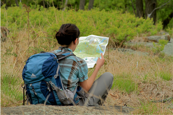
 Support the trails with a donation!
Trip Reports
rate experience
No reviews for this hike, click above rate experience link to review this hike
Log in or register to post comments